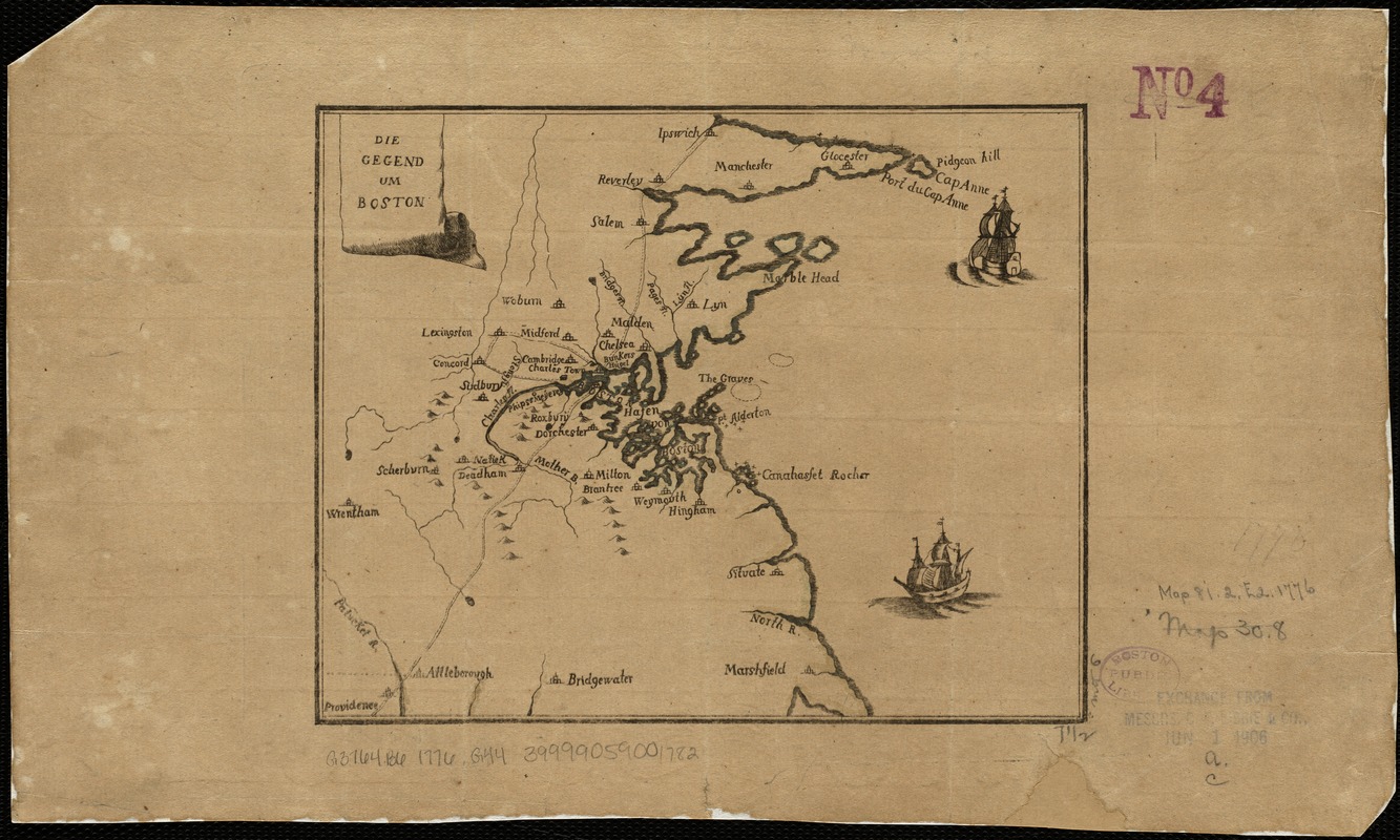
Die gegend um Boston
This map is also available in American Revolutionary Geographies Online (ARGO), a collections portal especially built for material relating to the American Revolutionary War Era. Visit ARGO to learn more about this item and explore the historical geography of North America in the late eighteenth century.
Item Information
- Title:
- Die gegend um Boston
- Date:
-
[1776?]
- Format:
-
Maps/Atlases
- Location:
-
Boston Public Library
Norman B. Leventhal Map Center - Collection (local):
-
Norman B. Leventhal Map Center Collection
- Subjects:
-
Boston (Mass.)--Maps--Early works to 1800
Massachusetts--Maps--Early works to 1800
- Places:
-
Suffolk (county)Boston
- Extent:
- 1 map : col. ; 16 x 19 cm.
- Terms of Use:
-
No known copyright restrictions.
No known restrictions on use.
- Publisher:
-
S.l :
s.n.
- Scale:
-
Scale not given.
- Language:
-
German
- Notes:
-
Relief shown pictorially.
Depicts Boston and vicinity, with two ships in the harbor.
Paper has large watermark.
- Identifier:
-
06_01_003724
- Call #:
-
G3764.B6 1776 .G44
- Barcode:
-
39999059001782


