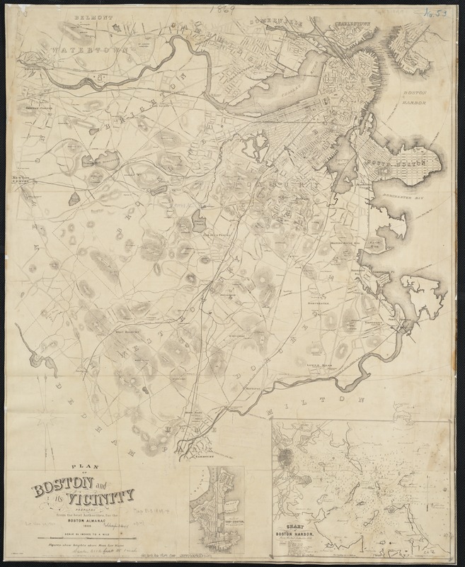
Plan of Boston and its vicinity
Item Information
- Title:
- Plan of Boston and its vicinity
- Creator:
- Coolidge, George, 1817-1888
- Name on Item:
-
prepared from the best authorities for the Boston Almanac ; A. Meisel, lith.
- Date:
-
1869
- Format:
-
Maps/Atlases
- Location:
-
Boston Public Library
Norman B. Leventhal Map Center - Collection (local):
-
Norman B. Leventhal Map Center Collection
- Subjects:
-
Boston (Mass.)--Maps
Boston Harbor (Mass.)--Maps
- Places:
-
Boston Harbor
Suffolk (county)Boston
- Extent:
- 1 map ; 71 x 57 cm.
- Terms of Use:
-
No known copyright restrictions.
No known restrictions on use.
- Publisher:
-
Boston, Mass :
[s.n.]
- Scale:
-
Scale [ca. 1:25,344].
- Language:
-
English
- Notes:
-
Relief shown by hachures and spot heights.
Depths shown by soundings.
Shows radial distances from City Hall; streets, districts, cemeteries and churches.
Insets: Plan of East Boston on a reduced scale -- Chart of Boston Harbor (scale [ca. 1:97,190]).
- Identifier:
-
06_01_003484
- Call #:
-
G3764.B6 1869 .C66
- Barcode:
-
39999059001329


