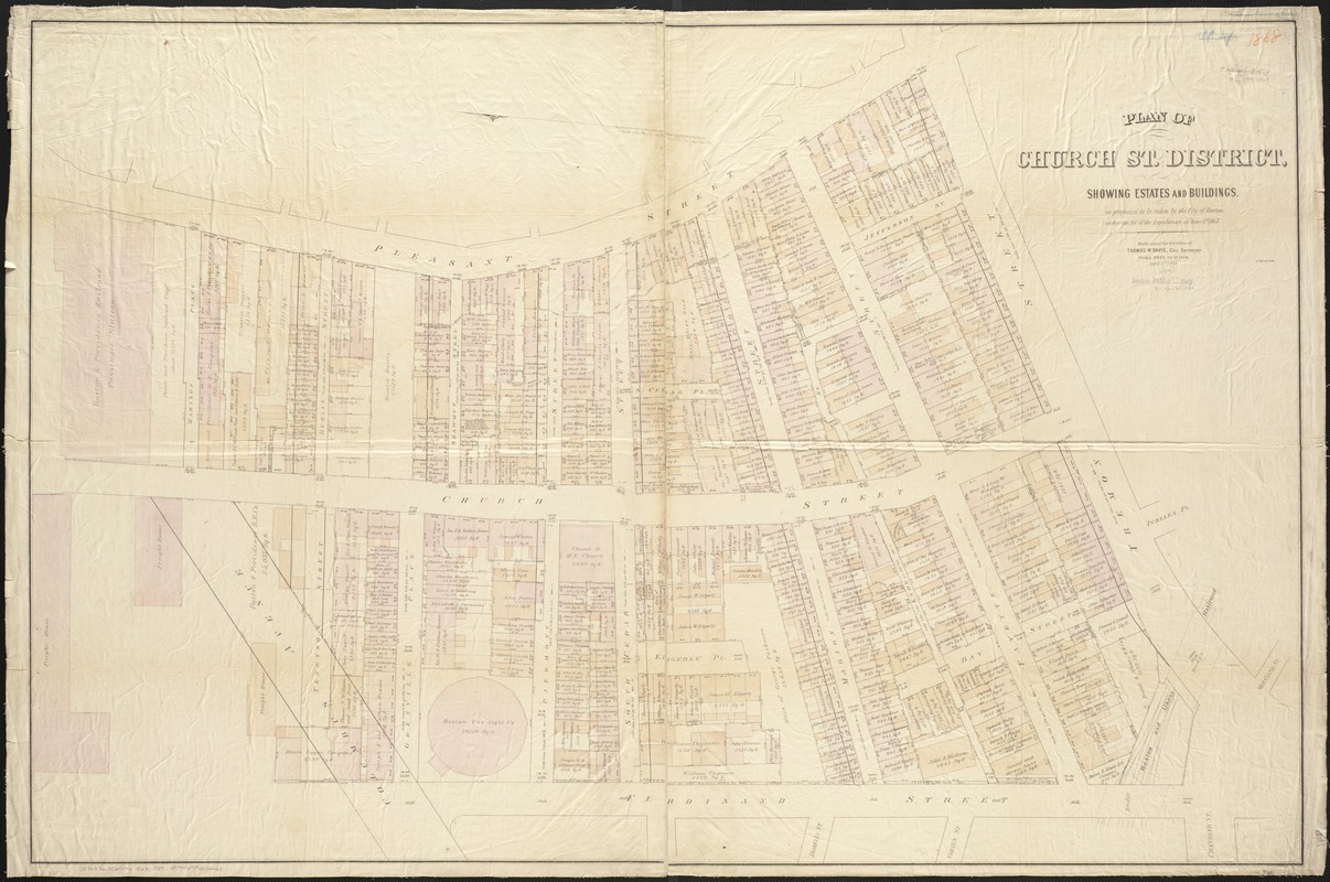
Plan of Church St. district, showing estates and buildings : as proposed to be taken by the city of Boston under the Act of the Legislature of June 1st, 1867
Item Information
- Title:
- Plan of Church St. district, showing estates and buildings : as proposed to be taken by the city of Boston under the Act of the Legislature of June 1st, 1867
- Creator:
- Davis, Thomas W., surveyor
- Name on Item:
-
made under the direction of Thomas W. Davis, city surveyor.
- Date:
-
1868
- Format:
-
Maps/Atlases
- Location:
-
Boston Public Library
Norman B. Leventhal Map Center - Collection (local):
-
Norman B. Leventhal Map Center Collection
- Subjects:
-
Real property--Massachusetts--Boston--Maps
Streets--Massachusetts--Boston--Maps
South End (Boston, Mass.)--Maps
Boston (Mass.)--Maps
- Places:
-
MassachusettsSuffolk (county)BostonSouth End
- Extent:
- 1 map : hand col. ; 84 x 127 cm.
- Terms of Use:
-
No known copyright restrictions.
No known restrictions on use.
- Publisher:
-
Boston, Mass :
[s.n.]
- Scale:
-
Scale [1:360].
- Language:
-
English
- Notes:
-
Cadastral map showing property street addresses, dimensions, areas, and owner names.
Shows also plans for laying out and widening of streets.
"Apr. 6th, 1868."
Oriented with north to the left.
- Identifier:
-
06_01_003479
- Call #:
-
G3764.B6:2S6G46 1868 .D39
- Barcode:
-
39999059001261


