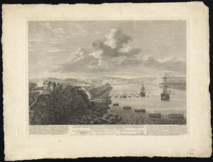
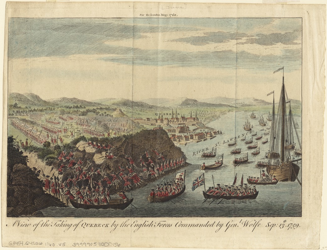
A view of the taking of Quebeck by the English forces commanded by Gen. Wolfe Sep. 13th 1759
This map is also available in American Revolutionary Geographies Online (ARGO), a collections portal especially built for material relating to the American Revolutionary War Era. Visit ARGO to learn more about this item and explore the historical geography of North America in the late eighteenth century.
Item Information
- Title:
- A view of the taking of Quebeck by the English forces commanded by Gen. Wolfe Sep. 13th 1759
- Date:
-
[1760]
- Format:
-
Maps/Atlases
- Location:
-
Boston Public Library
Norman B. Leventhal Map Center - Collection (local):
-
Norman B. Leventhal Map Center Collection
- Subjects:
-
Québec Campaign, Québec, 1759--Aerial views--Early works to 1800
Québec (Québec)--History--French and Indian War, 1754-1763--Aerial views--Early works to 1800
- Places:
-
CanadaQuébec
- Extent:
- 1 view : col. ; 17 x 25 cm.
- Terms of Use:
-
No known copyright restrictions.
No known restrictions on use.
- Publisher:
-
S.l :
s.n.
- Scale:
-
Not drawn to scale.
- Language:
-
English
- Notes:
-
Bird's-eye view.
"For the London Mag: 1760."
- Notes (date):
-
This date is inferred.
- Identifier:
-
06_01_003295
- Call #:
-
G3454.Q4S26 1760 .V5
- Barcode:
-
39999059000156