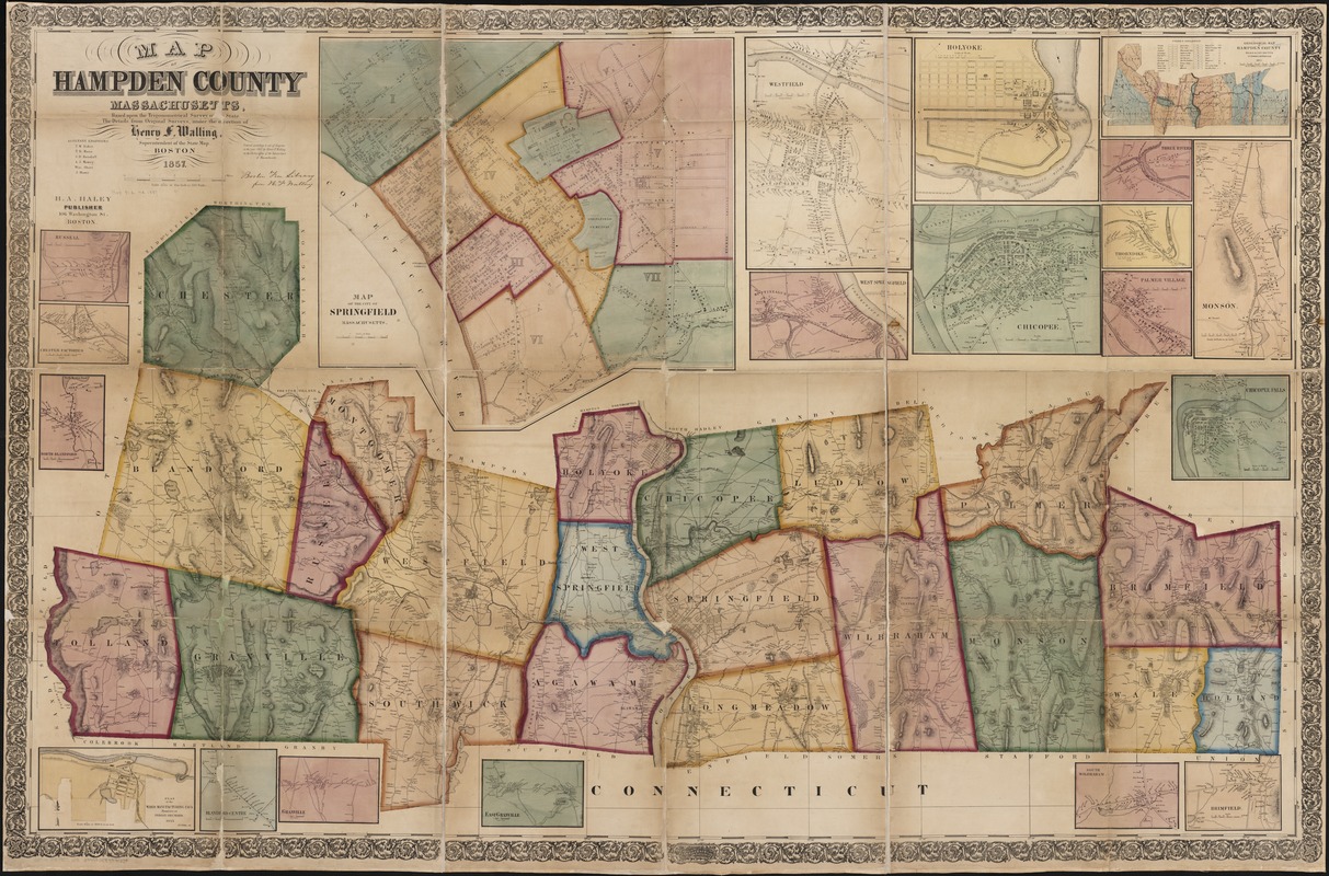
Map of Hampden County, Massachusetts : based upon the trigonometrical survey of the state
Item Information
- Title:
- Map of Hampden County, Massachusetts : based upon the trigonometrical survey of the state
- Creator:
- Walling, Henry Francis, 1825-1888
- Name on Item:
-
the details of which from original surveys, under the direction of Henry F. Walling.
- Date:
-
1857
- Format:
-
Maps/Atlases
- Location:
-
Boston Public Library
Norman B. Leventhal Map Center - Collection (local):
-
Norman B. Leventhal Map Center Collection
- Subjects:
-
Real property--Massachusetts--Hampden County--Maps
Hampden County (Mass.)--Maps
- Places:
-
Hampden (county)
- Extent:
- 1 map : hand col. ; 107 x 166 cm.
- Terms of Use:
-
No known copyright restrictions.
No known restrictions on use.
- Publisher:
-
Boston, Mass :
H.A. Haley
- Scale:
-
Scale 1:47,520.
- Language:
-
English
- Notes:
-
Shows buildings with names of property owners.
Relief shown by hachures.
"Entered according to act of Congress in the year 1855 by Henry F. Walling in the Clerks office of the District Court of Massachusetts."
Includes many cadastral insets of individual county towns and inset geological map of county.
- Identifier:
-
06_01_003231
- Call #:
-
G3763.H3 1857 .W3
- Barcode:
-
39999058999580