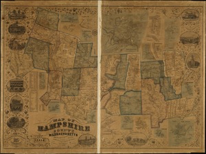
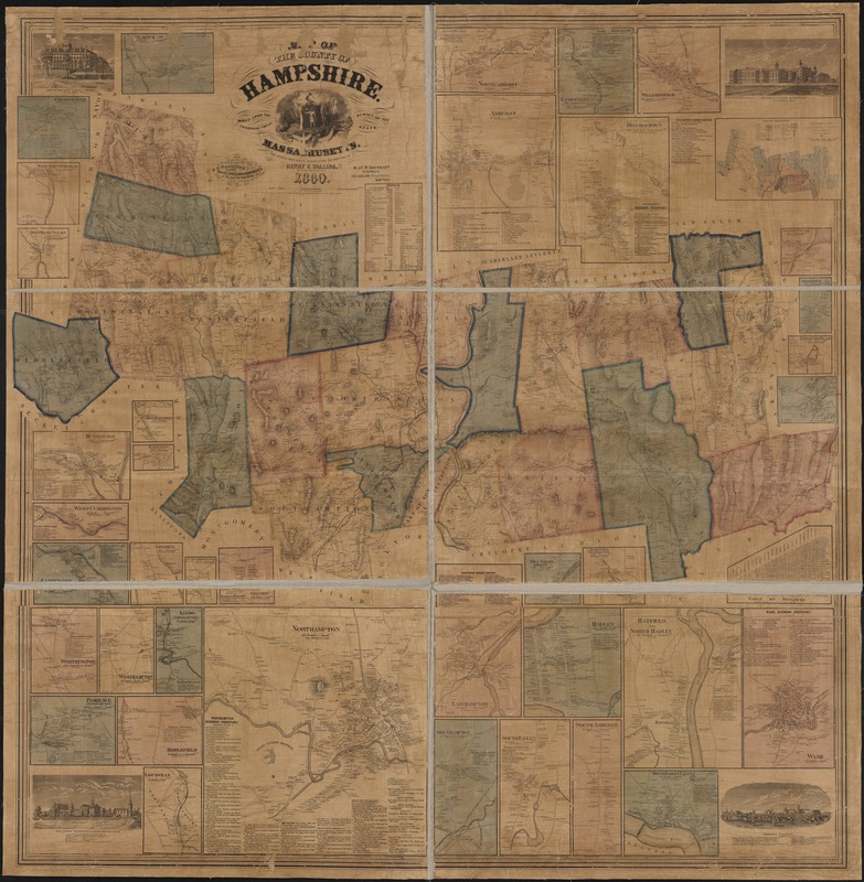
Map of the county of Hampshire, Massachusetts : based upon the trigonometrical survey of the state
Item Information
- Title:
- Map of the county of Hampshire, Massachusetts : based upon the trigonometrical survey of the state
- Creator:
- Walling, Henry Francis, 1825-1888
- Name on Item:
-
the details from actual surveys under the direction of Henry F. Walling ; engraved, printed, colored & mounted at H.F. Wallings Map Establishment.
- Date:
-
1860
- Format:
-
Maps/Atlases
- Location:
-
Boston Public Library
Norman B. Leventhal Map Center - Collection (local):
-
Norman B. Leventhal Map Center Collection
- Subjects:
-
Real property--Massachusetts--Hampshire County--Maps
Hampshire County (Mass.)--Maps
- Places:
-
Hampshire (county)
- Extent:
- 1 map : col. ; 147 x 146 cm.
- Terms of Use:
-
No known copyright restrictions.
No known restrictions on use.
- Publisher:
-
New York :
H. & C.T. Smith & Co.
- Scale:
-
Scale [1:47,520]. 240 rods to an in.
- Language:
-
English
- Notes:
-
Includes 38 insets of village centers (scales vary); table of distances; geologic map; statistics for population, manufacturing and agriculture in 1855; illustrations of Williston Seminary and Amherst College with lists of faculty; illustrations of State Lunatic Hospital in Northampton and Mount Holyoke Female Seminary in South Hadley.
Shows householders' names.
- Identifier:
-
06_01_003229
- Call #:
-
G3763.H4 1860 .W3
- Barcode:
-
39999058999572