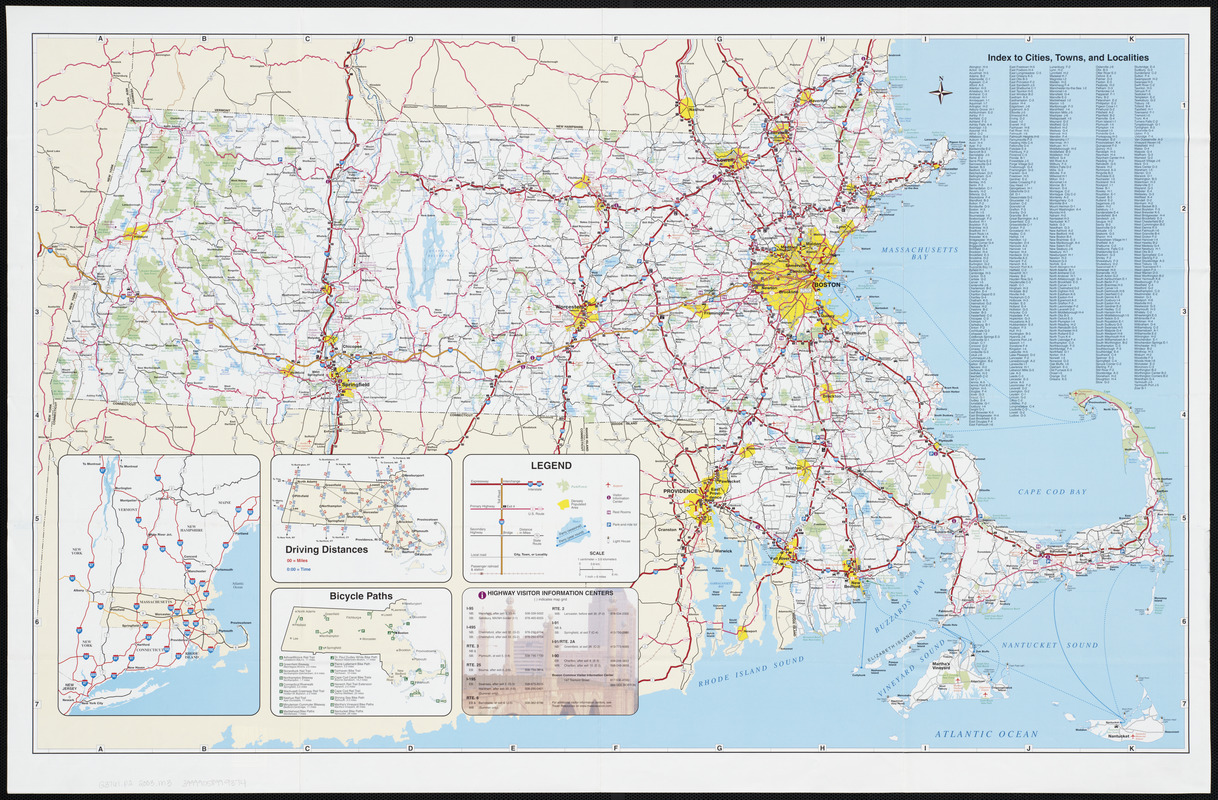
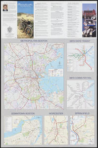
Massachusetts official transportation map

Item Information
- Title:
- Massachusetts official transportation map
- Cartographer:
- Metropolitan Planning Organization (Mass.). Central Transportation Planning Staff
- Name on Item:
-
design and cartography by the Central Transportation Planning Staff
- Date:
-
2003
- Format:
-
Maps/Atlases
- Location:
-
Boston Public Library
Norman B. Leventhal Map Center - Collection (local):
-
Norman B. Leventhal Map Center Collection
- Subjects:
-
Massachusetts--Maps
Roads--Massachusetts--Maps
Boston (Mass.)--Maps
Worcester (Mass.)--Maps
Springfield (Mass.)--Maps
- Places:
-
Suffolk (county)Boston
Worcester (county)Worcester
Hampden (county)Springfield
- Extent:
- 7 maps on 1 sheet : both sides, col. ; on sheet 56 x 86 cm.
- Terms of Use:
-
No known copyright restrictions.
No known restrictions on use.
- Publisher:
-
Boston, Mass. :
MassHighway
- Scale:
-
Scale approximately 1:420,000
- Language:
-
English
- Notes:
-
Panel title.
Includes index, location map showing interstate routes, maps of driving distances and bicycle paths, and guide to visitor information centers.
Text, col. ill., and maps of metropolitan Boston, downtown Boston with index to points of interest, Worcester, Springfield, MBTA commuter rail system and MBTA rapid transit system on verso.
- Identifier:
-
06_01_003207
06_01_003208
- Call #:
-
G3761.P2 2003 .M3
- Barcode:
-
39999058999374


