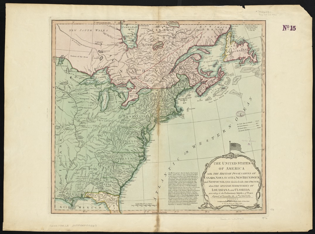
The United States of America with the British possessions of Canada, Nova Scotia, New Brunswick and Newfoundland divided with the French, also the Spanish territories of Louisiana and Florida according to the preliminary articles of peace signed at Versailles the 20th of Jany. 1783
This map is also available in American Revolutionary Geographies Online (ARGO), a collections portal especially built for material relating to the American Revolutionary War Era. Visit ARGO to learn more about this item and explore the historical geography of North America in the late eighteenth century.
Item Information
- Title:
- The United States of America with the British possessions of Canada, Nova Scotia, New Brunswick and Newfoundland divided with the French, also the Spanish territories of Louisiana and Florida according to the preliminary articles of peace signed at Versailles the 20th of Jany. 1783
- Creator:
- Robert Laurie and James Whittle
- Date:
-
1794
- Format:
-
Maps/Atlases
- Location:
-
Boston Public Library
Norman B. Leventhal Map Center - Collection (local):
-
Norman B. Leventhal Map Center Collection
- Subjects:
-
United States--Maps--Early works to 1800
Canada--Maps--Early works to 1800
- Places:
-
United States
Canada
- Extent:
- 1 map : col. ; 45 x 50 cm.
- Terms of Use:
-
No known copyright restrictions.
No known restrictions on use.
- Publisher:
-
London :
Laurie & Whittle
- Scale:
-
Scale [ca. 1:6,500,000].
- Language:
-
English
- Notes:
-
Relief shown pictorially.
Cataloging, conservation, and digitization made possible in part by The National Endowment for the Humanities: Exploring the human endeavor.
- Identifier:
-
06_01_003195
- Call #:
-
G3700 1794 .L3
- Barcode:
-
39999058999267
- LCCN:
-
98685649


