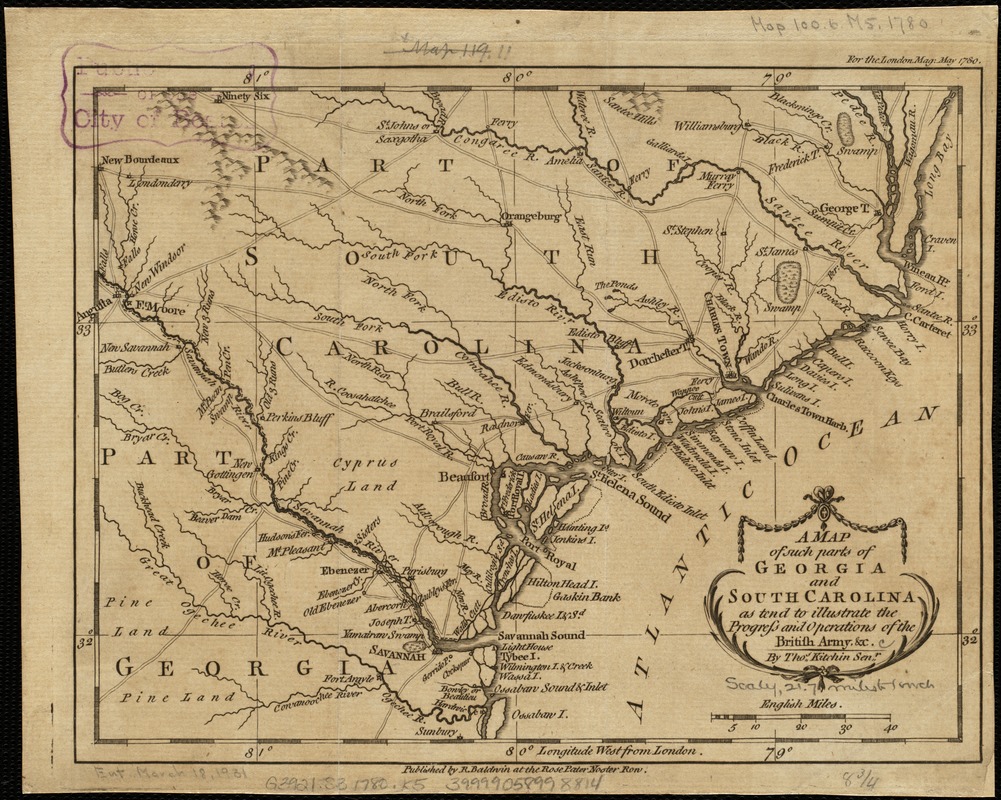
A map of such parts of Georgia and South Carolina as tend to illustrate the progress and operations of the British Army, &c
This map is also available in American Revolutionary Geographies Online (ARGO), a collections portal especially built for material relating to the American Revolutionary War Era. Visit ARGO to learn more about this item and explore the historical geography of North America in the late eighteenth century.
Item Information
- Title:
- A map of such parts of Georgia and South Carolina as tend to illustrate the progress and operations of the British Army, &c
- Creator:
- Kitchin, Thomas, d. 1784
- Name on Item:
-
by Thos. Kitchin senr.
- Date:
-
[1780]
- Format:
-
Maps/Atlases
- Location:
-
Boston Public Library
Norman B. Leventhal Map Center - Collection (local):
-
Norman B. Leventhal Map Center Collection
- Subjects:
-
Georgia--History--Revolution, 1775-1783--Maps--Early works to 1800
South Carolina--History--Revolution, 1775-1783--Maps--Early works to 1800
- Places:
-
Georgia
South Carolina
- Extent:
- 1 map ; 17 x 23 cm.
- Terms of Use:
-
No known copyright restrictions.
No known restrictions on use.
- Publisher:
-
[London] :
R. Baldwin
- Scale:
-
Scale [ca. 1:1,375,000].
- Language:
-
English
- Notes:
-
Relief shown pictorially.
"For the London Mag. May 1780."
- Notes (date):
-
This date is inferred.
- Identifier:
-
06_01_003137
- Call #:
-
G3921.S3 1780 .K5
- Barcode:
-
39999058998814