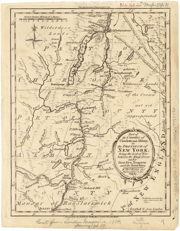
Part of the counties of Charlotte and Albany, in the Province of New York : being the seat of war between the King's forces under Lieut. Gen. Burgoyne and the rebel army
This map is also available in American Revolutionary Geographies Online (ARGO), a collections portal especially built for material relating to the American Revolutionary War Era. Visit ARGO to learn more about this item and explore the historical geography of North America in the late eighteenth century.
Item Information
- Title:
- Part of the counties of Charlotte and Albany, in the Province of New York : being the seat of war between the King's forces under Lieut. Gen. Burgoyne and the rebel army
- Creator:
- Kitchin, Thomas, d. 1784
- Name on Item:
-
by Thos. Kitchin Senr.
- Date:
-
[1778]
- Format:
-
Maps/Atlases
- Location:
-
Boston Public Library
Norman B. Leventhal Map Center - Collection (local):
-
Norman B. Leventhal Map Center Collection
- Subjects:
-
Washington County (N.Y.)--History--18th century--Maps--Early works to 1800
Albany County (N.Y.)--History--18th century--Maps--Early works to 1800
- Places:
-
Albany (county)
Washington (county)
- Extent:
- 1 map ; 25 x 19 cm.
- Terms of Use:
-
No known copyright restrictions.
No known restrictions on use.
- Publisher:
-
[London] :
Printed for R. Baldwin
- Scale:
-
Scale ca. 1:575,000.
- Language:
-
English
- Notes:
-
For the London magazine 1778.
Relief shown pictorially.
Shows forts and roads from Albany to Ticonderoga.
- Notes (date):
-
This date is inferred.
- Identifier:
-
06_01_003133
- Call #:
-
G3803.W3S3 1778 .K5
- Barcode:
-
39999058998772
- LCCN:
-
80693268


