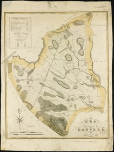
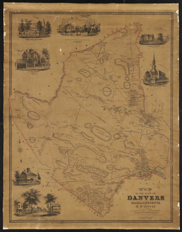
Map of the town of Danvers Massachusetts
Item Information
- Title:
- Map of the town of Danvers Massachusetts
- Creator:
- McIntyre, H. (Henry)
- Lithographer:
- Friend & Aub
- Printer:
- Wagner & M'Guigan
- Name on Item:
-
by H. McIntyre.
- Date:
-
[ca. 1852]
- Format:
-
Maps/Atlases
- Location:
-
Boston Public Library
Norman B. Leventhal Map Center - Collection (local):
-
Norman B. Leventhal Map Center Collection
- Subjects:
-
Danvers (Mass.)--Maps
- Places:
-
Essex (county)Danvers
- Extent:
- 1 map : col. ; 82 x 66 cm.
- Terms of Use:
-
No known copyright restrictions.
No known restrictions on use.
- Publisher:
-
Philad[elphi]a :
Pine & Perry
- Scale:
-
Scale 1:253,440.
- Language:
-
English
- Notes:
-
Relief shown by hachures.
Oriented with north toward the upper left.
Includes seven illustrations of points of interest.
- Identifier:
-
06_01_003049
- Call #:
-
G3764.D25 1852 .M3
- Barcode:
-
39999058997428