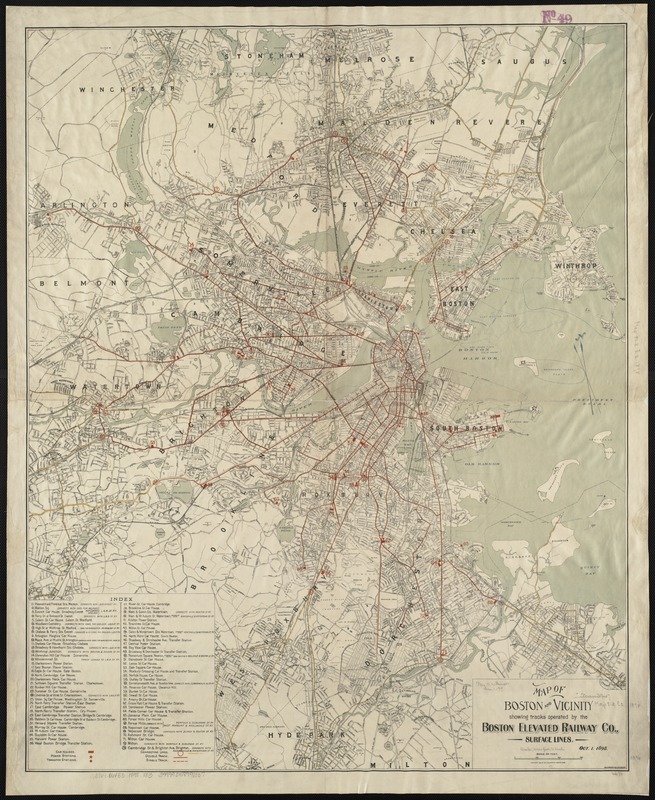
Map of Boston and vicinity showing tracks operated by the Boston Elevated Railway Co., surface lines
Item Information
- Title:
- Map of Boston and vicinity showing tracks operated by the Boston Elevated Railway Co., surface lines
- Date:
-
1898
- Format:
-
Maps/Atlases
- Location:
-
Boston Public Library
Norman B. Leventhal Map Center - Collection (local):
-
Norman B. Leventhal Map Center Collection
- Subjects:
-
Boston Elevated Railway Company
Street-railroads--Massachusetts--Boston--Maps
Boston (Mass.)--Maps
Massachusetts--Maps
- Places:
-
Suffolk (county)Boston
- Extent:
- 1 map : col. ; 86 x 69 cm.
- Terms of Use:
-
No known copyright restrictions.
No known restrictions on use.
- Publisher:
-
Boston, Mass :
[Geo. H. Walker & Co.]
- Scale:
-
Scale 1:28,800.
- Language:
-
English
- Notes:
-
Relief shown by spot heights.
Oriented with north toward the upper left.
Includes index to stations.
- Identifier:
-
06_01_003041
- Call #:
-
G3764.B6P33 1898 .M3
- Barcode:
-
39999058997337


