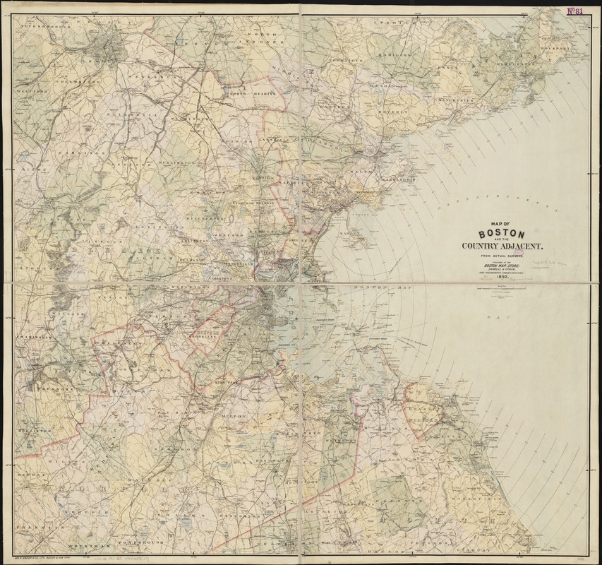
Map of Boston and the country adjacent from actual surveys
Item Information
- Title:
- Map of Boston and the country adjacent from actual surveys
- Date:
-
[ca. 1892]
- Format:
-
Maps/Atlases
- Location:
-
Boston Public Library
Norman B. Leventhal Map Center - Collection (local):
-
Norman B. Leventhal Map Center Collection
- Subjects:
-
Boston (Mass.)--Maps
Massachusetts--Maps
- Places:
-
Suffolk (county)Boston
- Extent:
- 1 map : col. ; 112 x 123 cm.
- Terms of Use:
-
No known copyright restrictions.
No known restrictions on use.
- Publisher:
-
Boston, Mass :
Damrell & Upham
- Scale:
-
Scale [ca. 1:64,000]
- Language:
-
English
- Notes:
-
Shows roads, town and county boundaries, radial distances from Boston State House, railroads and steamer routes.
Relief shown by contours.
- Identifier:
-
06_01_003035
- Call #:
-
G3764.B6 1892 .M3
- Barcode:
-
39999058997279


![[Boston and Northwestern Junction Railroad]](https://bpldcassets.blob.core.windows.net/derivatives/images/commonwealth:x059cc74n/image_thumbnail_300.jpg)

