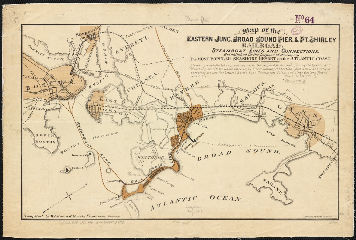
Map of the eastern junc. Broad Sound Pier, & Pt. Shirley railroad : steamboat lines and connections : established for the purpose of developing the most popular seashore resort on the Atlantic Coast
Item Information
- Title:
- Map of the eastern junc. Broad Sound Pier, & Pt. Shirley railroad : steamboat lines and connections : established for the purpose of developing the most popular seashore resort on the Atlantic Coast
- Name on Item:
-
compiled by Whitman & Breck, Engineers.
- Date:
-
[1880–1889]
- Format:
-
Maps/Atlases
- Location:
-
Boston Public Library
Norman B. Leventhal Map Center - Collection (local):
-
Norman B. Leventhal Map Center Collection
- Subjects:
-
Railroads--Massachusetts--Maps
Boston (Mass.)--Maps
Point Shirley (Mass.)--Maps
Boston Harbor (Mass.)--Maps
- Places:
-
Boston Harbor
Suffolk (county)WinthropPoint Shirley
Suffolk (county)Boston
- Extent:
- 1 map : col. ; 35 x 55 cm.
- Terms of Use:
-
No known copyright restrictions.
No known restrictions on use.
- Publisher:
-
Boston, Mass :
s.n.
- Scale:
-
Scale not given.
- Language:
-
English
- Notes:
-
Oriented with north toward the upper right.
"Affording a delightful trip, and resort, for the people of Boston, and opening the Revere and Winthrop shore to the whole interior ..."
- Notes (date):
-
This date is inferred.
- Identifier:
-
06_01_002680
- Call #:
-
G3762.B74 1880 .M3
- Barcode:
-
39999058997113
![[Boston and Northwestern Junction Railroad]](https://bpldcassets.blob.core.windows.net/derivatives/images/commonwealth:x059cc74n/image_thumbnail_300.jpg)


