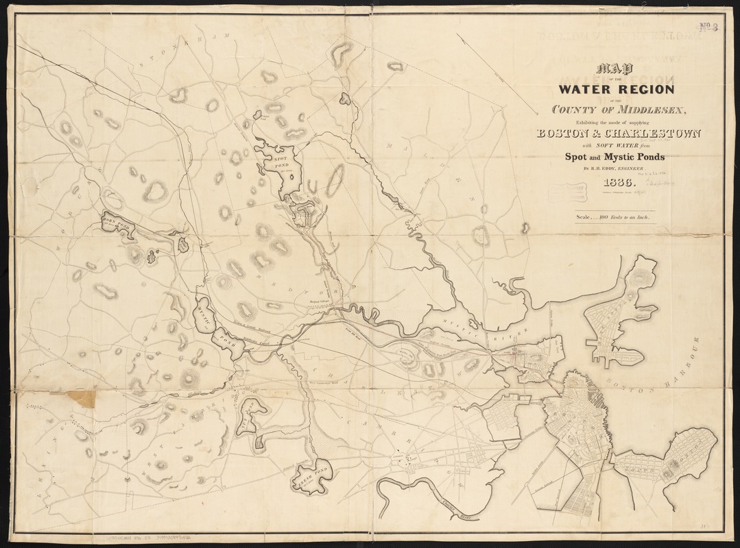
Map of the water region of the county of Middlesex exhibiting the mode of supplying Boston & Charlestown with soft water from Spot and Mystic Ponds
Item Information
- Title:
- Map of the water region of the county of Middlesex exhibiting the mode of supplying Boston & Charlestown with soft water from Spot and Mystic Ponds
- Creator:
- Eddy, R. H. (Robert Henry), 1812-1887
- Name on Item:
-
by R.H. Eddy, engineer.
- Date:
-
1836
- Format:
-
Maps/Atlases
- Location:
-
Boston Public Library
Norman B. Leventhal Map Center - Collection (local):
-
Norman B. Leventhal Map Center Collection
- Subjects:
-
Water-supply--Massachusetts--Middlesex County--Maps
Water-supply--Massachusetts--Boston--Maps
Middlesex County (Mass.)--Maps
Boston (Mass.)--Maps
- Places:
-
Suffolk (county)Boston
Middlesex (county)
- Extent:
- 1 map : hand col. ; 75 x 100 cm.
- Terms of Use:
-
No known copyright restrictions.
No known restrictions on use.
- Publisher:
-
Boston, Mass :
Pendleton's Lithography
- Scale:
-
Scale [1:19,800].
- Language:
-
English
- Notes:
-
Shows conduits from Spot Pond and Mystic Pond to Charlestown and Boston.
Relief shown by hachures.
Oriented with north toward the upper left.
- Identifier:
-
06_01_002664
- Call #:
-
G3763.M5N44 1836 .E3
- Barcode:
-
39999058996842


