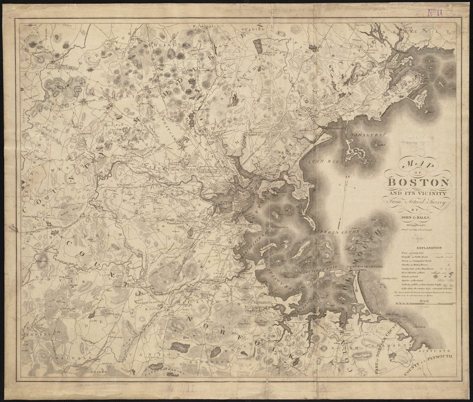
Map of Boston and its vicinity from actual surveys
Item Information
- Title:
- Map of Boston and its vicinity from actual surveys
- Creator:
- Hales, John Groves
- Name on Item:
-
by John Groves Hales ; Edwin Gillingham sc.
- Date:
-
1833
- Format:
-
Maps/Atlases
- Location:
-
Boston Public Library
Norman B. Leventhal Map Center - Collection (local):
-
Norman B. Leventhal Map Center Collection
- Subjects:
-
Boston (Mass.)--Maps
Massachusetts--Maps
- Places:
-
MassachusettsSuffolk (county)Boston
- Extent:
- 1 map ; 63 x 78 cm.
- Terms of Use:
-
No known copyright restrictions.
No known restrictions on use.
- Publisher:
-
Boston, Mass :
[John G. Hales]
- Scale:
-
Scale ca. 1:63,360
- Language:
-
English
- Notes:
-
Relief shown by hachures and spot heights.
Oriented with north toward the upper right.
Shows Boston & Providence, Boston & Worcester, and Boston & Lowell railroads.
"With corrections in 1833."
- Identifier:
-
06_01_002663
- Call #:
-
G3764.B6 1833 .H3
- Barcode:
-
39999058996834


![[Boston and Northwestern Junction Railroad]](https://bpldcassets.blob.core.windows.net/derivatives/images/commonwealth:x059cc74n/image_thumbnail_300.jpg)

