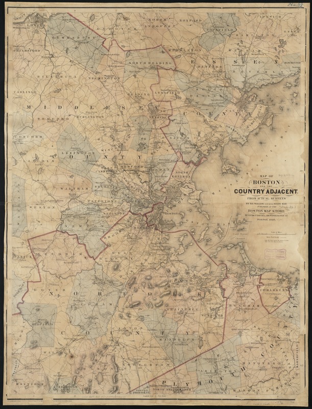
Map of Boston and the country adjacent from actual surveys
Item Information
- Title:
- Map of Boston and the country adjacent from actual surveys
- Creator:
- Walling, Henry Francis, 1825-1888
- Name on Item:
-
by H.F. Walling.
- Date:
-
1860
- Format:
-
Maps/Atlases
- Location:
-
Boston Public Library
Norman B. Leventhal Map Center - Collection (local):
-
Norman B. Leventhal Map Center Collection
- Subjects:
-
Boston (Mass.)--Maps
- Places:
-
Suffolk (county)Boston
- Extent:
- 1 map : col. ; 102 x 76 cm.
- Terms of Use:
-
No known copyright restrictions.
No known restrictions on use.
- Publisher:
-
Boston, Mass :
Pub. at the Boston Map Store by E.P. Dutton & Co.
- Scale:
-
Scale [ca. 1:63,360].
- Language:
-
English
- Notes:
-
Shows buildings, roads, railroads, aqueduct, mills, and quarries.
Relief shown by hachures.
In lower right margin: Entered according to the Act of Congress by E.P. Dutton & Co. in the Clerks Office of the U.S. District Court for the district of Mass.
Prime meridian: Boston.
- Identifier:
-
06_01_002653
- Call #:
-
G3764.B6A1 1860 .W3
- Barcode:
-
39999058996685


