Plan of Charles River : from the Waltham line to Boston harbor
Item Information
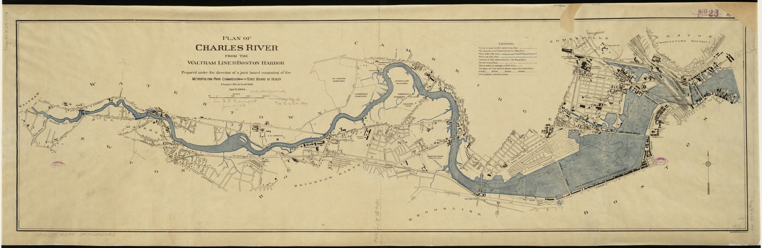
- Title:
- Plan of Charles River : from the Waltham line to Boston harbor
- Creator:
- Massachusetts. Metropolitan Park Commission
- Name on Item:
-
prepared under the direction of a joint board consisting of the Metropolitan Park Commission and the State Board of Health.
- Date:
-
1894
- Format:
-
Maps/Atlases
- Location:
-
Boston Public Library
Norman B. Leventhal Map Center - Collection (local):
-
Norman B. Leventhal Map Center Collection
- Subjects:
-
Charles River (Mass.)--Maps
- Places:
-
Charles (river)
- Extent:
- 1 map : col. ; 33 x 114 cm.
- Terms of Use:
-
No known copyright restrictions.
No known restrictions on use.
- Publisher:
-
[Boston, Mass.] :
Metropolitan Park Commission
- Scale:
-
Scale 1:12,000.
- Language:
-
English
- Notes:
-
April 1894.
"Chapter 475, Acts of 1893."
"Plan no. 1."
From: Massachusetts House document 775, 1894.
- Identifier:
-
06_01_002651
- Call #:
-
G3762.C5 1894 .P5
- Barcode:
-
39999059009785
30000008445760


