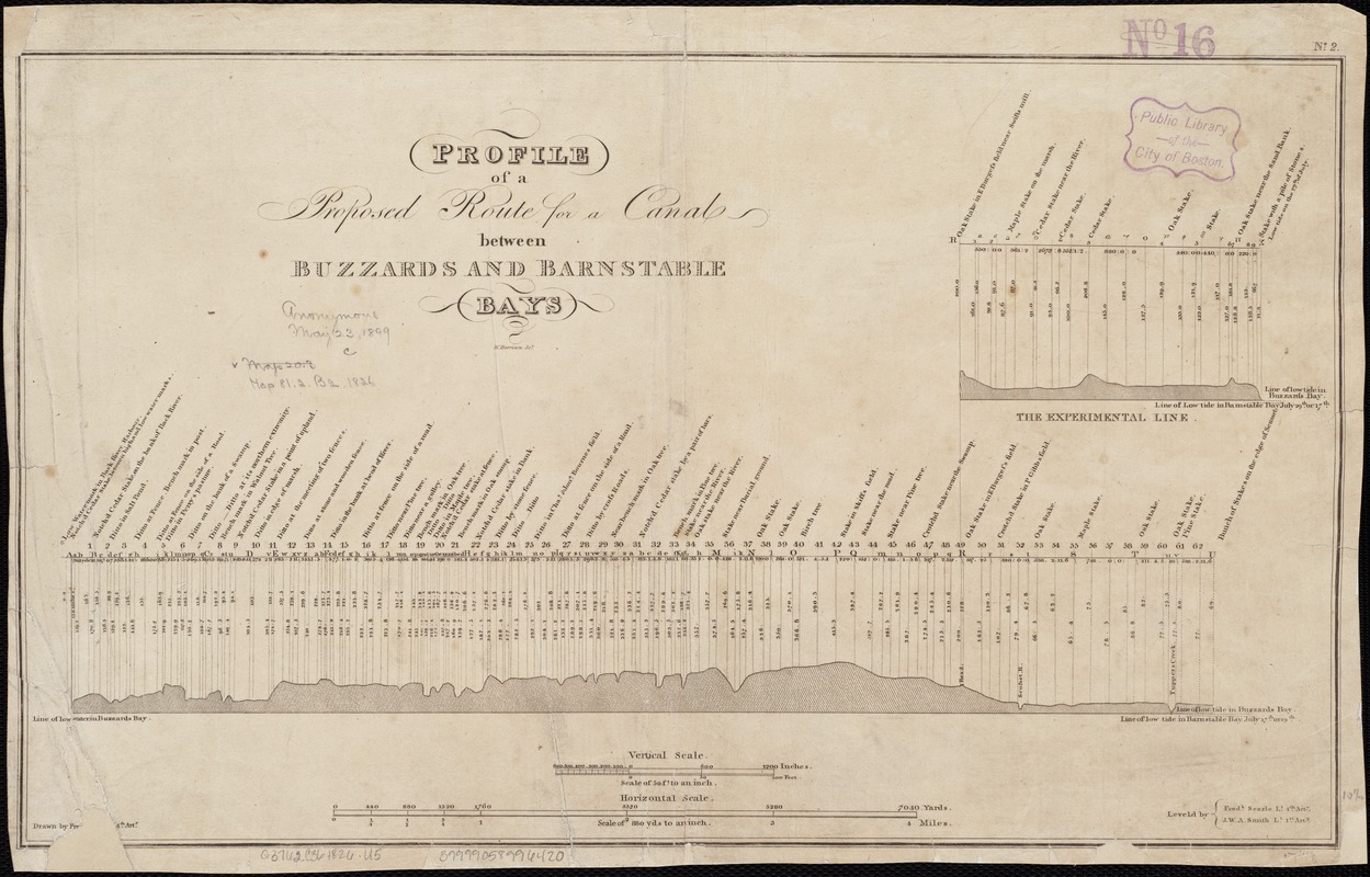
Profile of a proposed route for a canal between Buzzards and Barnstable Bays
Item Information
- Title:
- Profile of a proposed route for a canal between Buzzards and Barnstable Bays
- Name on Item:
-
drawn by Fre[dk. Seale] Lt. 4th Arty. ; Leveld. by Fredk. Seale Lt. 4th Arty., J.W.A. Smith, Lt. 1st Arty. ; W. Harrison sc.
- Date:
-
[1826]
- Format:
-
Maps/Atlases
- Location:
-
Boston Public Library
Norman B. Leventhal Map Center - Collection (local):
-
Norman B. Leventhal Map Center Collection
- Subjects:
-
Canals--Massachusetts--Cape Cod--Maps
Cape Cod Canal (Mass.)--Maps
- Places:
-
Cape Cod Canal
- Extent:
- 1 map ; 27 x 45 cm.
- Terms of Use:
-
No known copyright restrictions.
No known restrictions on use.
- Publisher:
-
Washington, D.C :
War Dept.
- Scale:
-
Scales differ.
- Language:
-
English
- Notes:
-
In upper right margin: "No. 2."
Appears in House Doc. no.174. 19th Congress, 1st session.
Shows "The Experimental Line."
- Notes (date):
-
This date is inferred.
- Identifier:
-
06_01_002633
- Call #:
-
G3762.C36 1826 .P76x
- Barcode:
-
39999058996420


