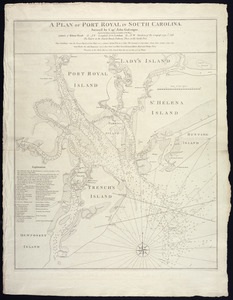
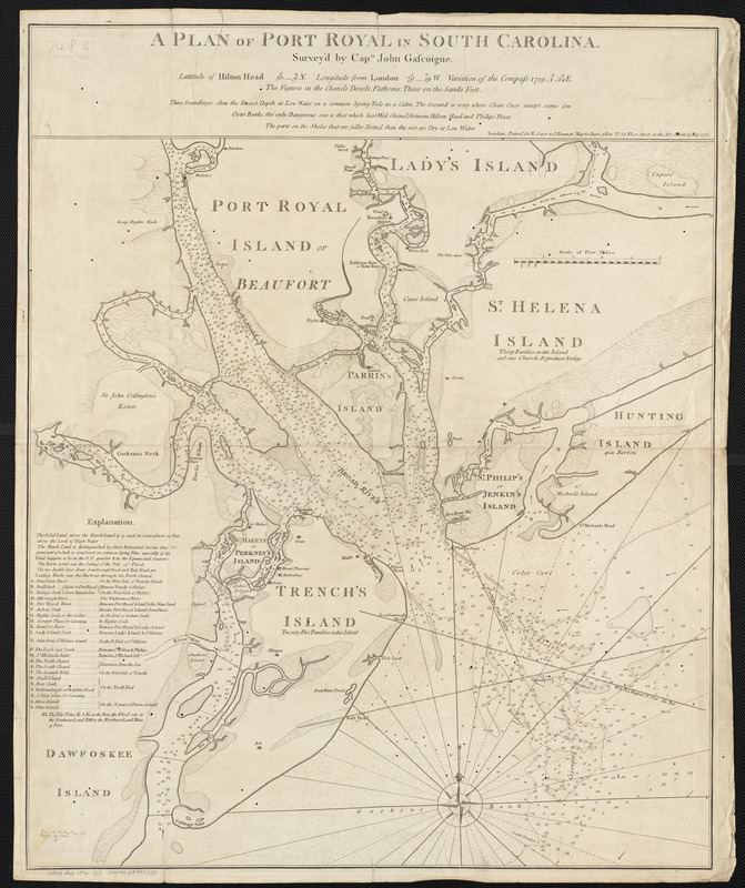
A plan of Port Royal in South Carolina
This map is also available in American Revolutionary Geographies Online (ARGO), a collections portal especially built for material relating to the American Revolutionary War Era. Visit ARGO to learn more about this item and explore the historical geography of North America in the late eighteenth century.
Item Information
- Title:
- A plan of Port Royal in South Carolina
- Creator:
- Gascoigne, John.
- Name on Item:
-
survey'd by Capn. John Gascoigne.
- Date:
-
1776
- Format:
-
Maps/Atlases
- Location:
-
Boston Public Library
Norman B. Leventhal Map Center - Collection (local):
-
Norman B. Leventhal Map Center Collection
- Subjects:
-
Nautical charts--South Carolina--Port Royal Sound
Port Royal Sound (S.C.)--Maps--Early works to 1800
- Places:
-
Beaufort (county)Port Royal Sound (bay)
- Extent:
- 1 map ; 62 x 58 cm.
- Terms of Use:
-
No known copyright restrictions.
No known restrictions on use.
- Publisher:
-
London :
printed for R. Sayer & J. Bennett ...
- Scale:
-
Scale 1:63,360.
- Language:
-
English
- Notes:
-
Depths shown by soundings.
"Latitude of Hilton Head ... Longitude from London ... variation of the compass ..."
"These soundings shew the exact depth at low water on a common spring tide in a calm ..."
- Identifier:
-
06_01_002541
- Call #:
-
G3912.P62 1776 .G3
- Barcode:
-
39999058995430