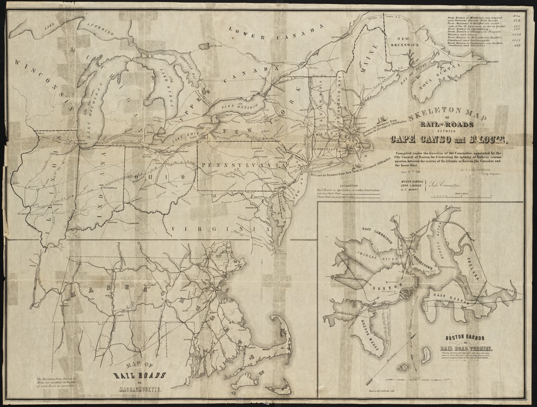
Skeleton map of rail-roads between Cape Canso and St. Louis
Item Information
- Title:
- Skeleton map of rail-roads between Cape Canso and St. Louis
- Creator:
- Chesbrough, Ellis Sylvester, 1813-1886
- Name on Item:
-
compiled under the direction of the Committee appointed by the City Council of Boston for celebrating the opening of Railway Communication between the waters of the Atlantic at Boston, the canadas and the Great west ; by E.S. Chesbrough, city engineer.
- Date:
-
1851
- Format:
-
Maps/Atlases
- Location:
-
Boston Public Library
Norman B. Leventhal Map Center - Collection (local):
-
Norman B. Leventhal Map Center Collection
- Subjects:
-
Railroads--United States--Maps
Massachusetts--Maps
United States--Maps
- Places:
-
Massachusetts
- Extent:
- 1 map ; 60 x 79 cm.
- Terms of Use:
-
No known copyright restrictions.
No known restrictions on use.
- Publisher:
-
Boston, Mass :
Tappan & Bradford's Lith.
- Scale:
-
Scale ca. 1:3,375,000.
- Language:
-
English
- Notes:
-
Shows railroads in operation or under construction and projected railroads in the northeastern United States and part of Canada.
Includes distance chart and insets "Map of rail roads in Massachusetts" and "Boston Harbor & rail road termini."
- Identifier:
-
06_01_002306
- Call #:
-
G3701.P3 1851 .C5
- Barcode:
-
39999058993823
- LCCN:
-
gm 70002892


