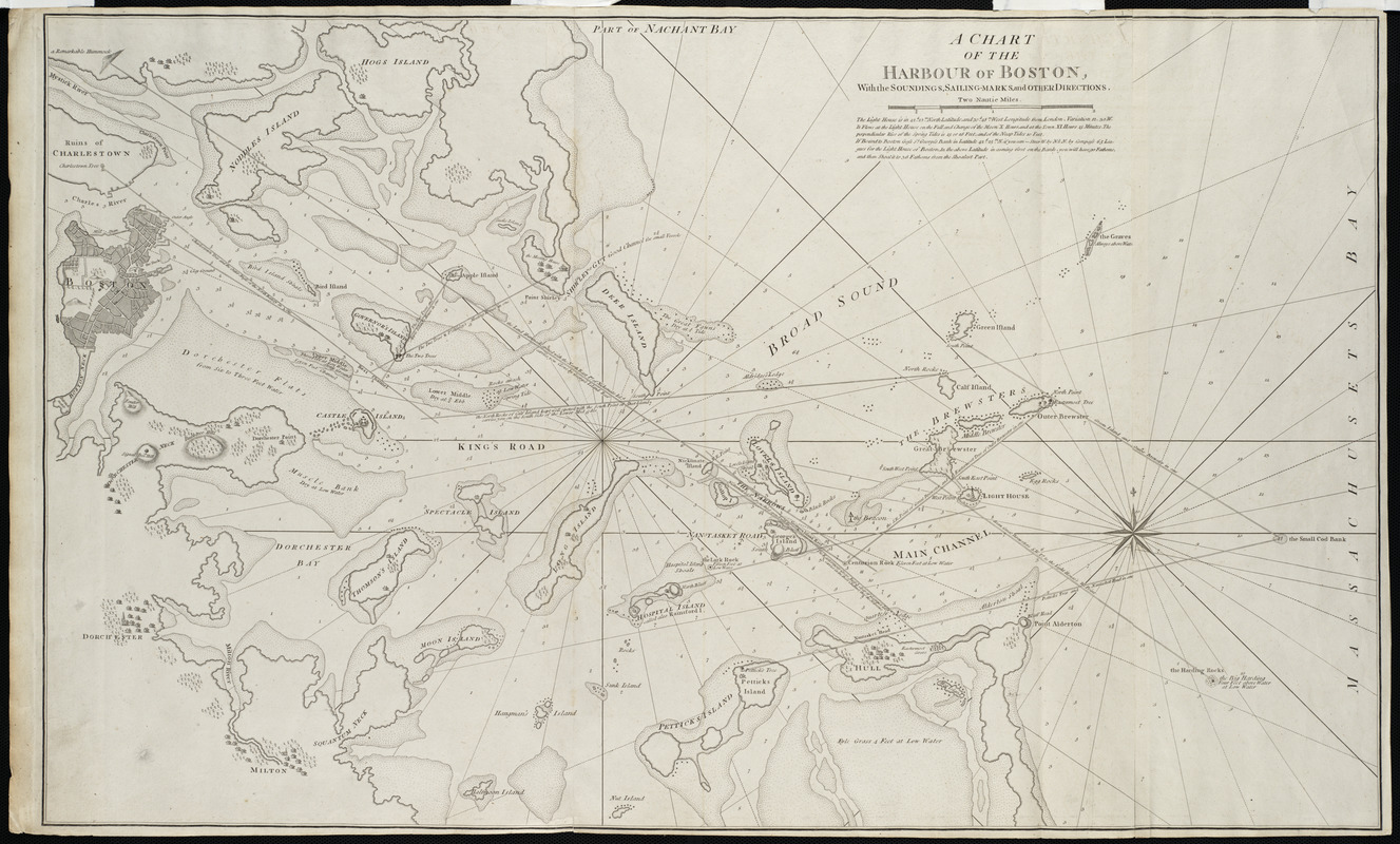
A chart of the Harbour of Boston, with the soundings, sailing-marks and other directions
Item Information
- Title:
- A chart of the Harbour of Boston, with the soundings, sailing-marks and other directions
- Description:
-
One of the last of the 18th-century nautical surveys of Boston Harbor, this chart contains many aids to navigation, including soundings, sailing marks, and other directions. The atlas from which it is taken was first published in 1775 by London publishers Robert Sayer and John Bennett. The atlas was later expanded by their assistants and successors Robert Laurie and James Whittle to include this and other charts. It was one of the three successful marine atlases published in England to replace the obsolete The English Pilot.
- Contributor:
- Robert Laurie and James Whittle
- Date:
-
[1800]
- Format:
-
Maps/Atlases
- Location:
- Private Collection
- Collection (local):
-
Mapping Boston Collection
- Subjects:
-
Nautical charts--Massachusetts--Boston Harbor
Boston Harbor (Mass.)--Maps
- Places:
-
Boston Harbor
- Extent:
- 1 chart ; 53 x 87 cm.
- Terms of Use:
-
No known copyright restrictions.
This work is licensed for use under a Creative Commons Attribution Non-Commercial Share Alike License (CC BY-NC-SA).

- Publisher:
-
London :
R. Laurie & J. Whittle
- Scale:
-
Scale not given
- Language:
-
English
- Notes:
-
Depth shown by soundings.
Relief shown by hachures.
Includes depictions of fortifications and settlements.
Appears in The North American Pilot. London. 1800.
- Notes (date):
-
This date is inferred.
- Identifier:
-
06_01_001207
- Barcode:
-
39999052508585


