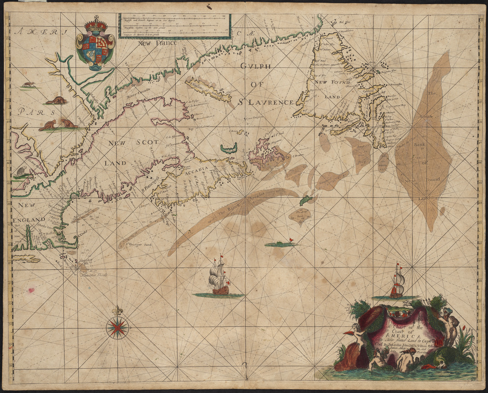
A chart of the coast of America from New found Land to Cape Cod
Item Information
- Title:
- A chart of the coast of America from New found Land to Cape Cod
- Description:
-
Published in Seller's Atlas Maritimus, the earliest general marine atlas produced in England, this was the first English chart of New England waters. It clearly shows the northern navigation routes with soundings, as well as the islands and lucrative fishing banks off the coasts of Nova Scotia and Newfoundland. Boston and Charlestown are also located and named. While the Atlas Maritimus was Seller's first attempt at breaking the Dutch monopoly on the publication of nautical atlases, he is also credited with the inception of The English Pilot, the standard guide for English navigators throughout the 18th century.
- Creator:
- Seller, John, fl. 1658-1698
- Contributor:
- Colson, John
- Contributor:
- Fisher, William
- Contributor:
- Atkinson, J. (James)
- Contributor:
- Thornton, John, 1641-1708
- Name on Item:
-
by Jonh [sic] Seller ... [et. al.]
- Date:
-
[1675]
- Format:
-
Maps/Atlases
- Location:
- Private Collection
- Collection (local):
-
Mapping Boston Collection
- Subjects:
-
Atlantic Provinces--Maps--Early works to 1800
New England--Maps--Early works to 1800
- Places:
-
New England (area)
CanadaProvince of Prince Edward Island (province)
- Extent:
- 1 map : hand col. ; 42 x 54 cm.
- Terms of Use:
-
No known copyright restrictions.
This work is licensed for use under a Creative Commons Attribution Non-Commercial Share Alike License (CC BY-NC-SA).

- Publisher:
-
London :
s.n.
- Scale:
-
Scale [ca. 1:15,800,000]
- Language:
-
English
- Notes:
-
Appears in Seller's Atlas Maritimus. London. 1675.
Depths shown by soundings.
- Notes (date):
-
This date is inferred.
- Identifier:
-
06_01_001225
- Barcode:
-
39999052508320


