Americae siue noui orbis, noua descriptio
Item Information
- Title:
- Americae siue noui orbis, noua descriptio
- Title (alt.):
-
Americae sive novi orbis, nova descriptio
- Description:
-
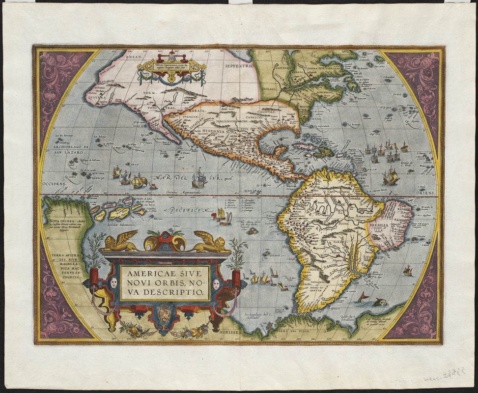
In 1587, Ortelius revised the map of the Americas that appeared in his Theatrum Orbis Terrarum. The changes found on this second edition are more extensive than generally thought, and are evidence of the care that he took in keeping his maps as current as possible. The most apparent change was the removal of the large bulge on the west coast of South America. On the east coast of North America, an eastward flowing river, which may be the Chesapeake Bay, was also added. If correctly identified, this would be the first appearance of the Chesapeake Bay on a printed map.
- Creator:
- Ortelius, Abraham, 1527-1598
- Date:
-
1587
- Format:
-
Maps/Atlases
- Location:
- Private Collection
- Collection (local):
-
Mapping Boston Collection
- Subjects:
-
America--Maps--Early works to 1800
Western Hemisphere--Maps--Early works to 1800
- Places:
-
North and Central America
South America
Mesoamerica (area)
North America (area)
South America
America
- Extent:
- 1 map : hand col. ; 35 x 48 cm.
- Terms of Use:
-
No known copyright restrictions.
This work is licensed for use under a Creative Commons Attribution Non-Commercial Share Alike License (CC BY-NC-SA).

- Publisher:
-
Antwerp :
[s.n.]
- Scale:
-
Scale [ca. 1:42,000,000]
- Language:
-
Latin
- Notes:
-
Title from ornamental cartouche.
Prime meridian: Ferro.
Relief shown pictorially.
"Cum privilegio decennali ab Ortelius delineab et execudeb. 1587."
Decorative corners & title.
- Identifier:
-
06_01_001144
- Barcode:
-
39999052507348


